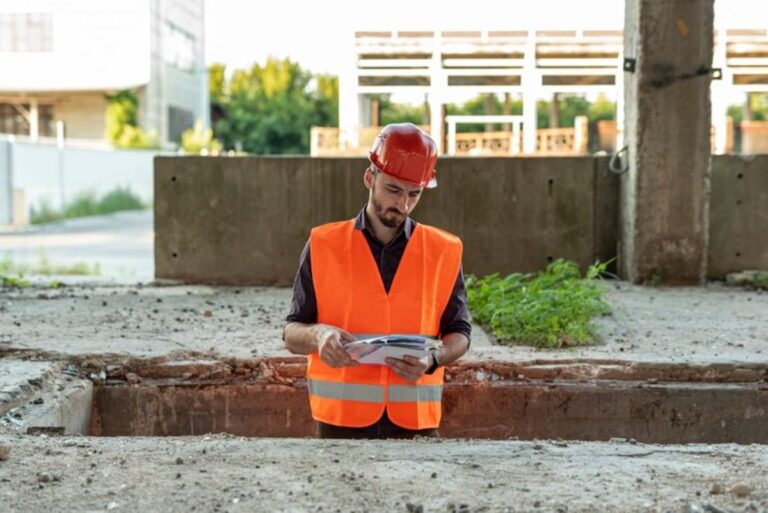
Registered surveyors are crucial professionals in the property and construction industries, with expertise in both land surveys and utility locating services. These licensed specialists combine technical knowledge with precision tools to deliver accurate measurements and detailed mapping of both surface and subsurface features.
The ability of registered surveyors to perform both tasks is extremely valuable for various projects:
- Property Development: Establishing precise boundary lines and identifying underground utilities
- Infrastructure Projects: Mapping existing structures and detecting subsurface installations
- Construction Planning: Providing comprehensive site assessments for safe, efficient development
Using advanced technology and strict methods, registered surveyors produce detailed documents of property boundaries, topographical features, and underground utility networks. This integrated approach to land surveys and utility locating provides vital information for property owners, developers, and construction teams.
The knowledge of registered surveyors helps avoid expensive delays, lowers safety risks, and guarantees adherence to regulatory requirements in residential, commercial, and infrastructure projects.
Understanding Registered Surveyors
Registered surveyors are highly skilled professionals who must meet strict licensing requirements to practice. Here’s how someone becomes a registered surveyor:
- Complete an accredited degree in surveying
- Gain a minimum of 2 years supervised practical experience
- Pass professional competency assessments
- Register with state surveying boards
These licensed professionals perform important land surveying tasks that require precision and technical expertise. Their main responsibilities include:
- Determining and establishing boundaries
- Mapping topography and analysing terrain
- Planning and designing subdivisions
- Creating legal survey documents
- Investigating property titles
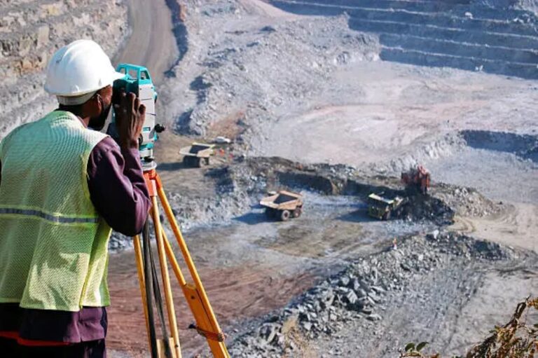
The accuracy of their work depends on specialised equipment and advanced surveying methods:
Field Equipment
- Total stations for measuring angles and distances
- GPS/GNSS receivers for precise positioning
- Digital levels for determining elevation
- Laser scanners for capturing 3D data
Technical Methods
- Establishing control networks
- Performing coordinate geometry calculations
- Using computer-aided drafting (CAD)
- Applying geographic information systems (GIS)
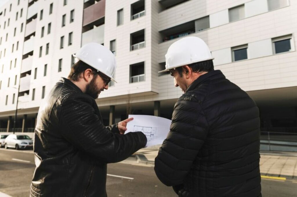
Registered surveyors must strictly follow technical standards while carrying out these tasks. Their work is crucial for property transactions, construction projects, and infrastructure development. The combination of formal qualifications, practical experience, and technological proficiency ensures accurate and reliable surveying services across various projects.
Land Surveying: The Foundation of Property and Construction Projects
Land surveys are crucial legal documents that define property boundaries and safeguard landowner rights. These in-depth evaluations provide an official account of property size, height, and physical characteristics, which are vital for:
- Legal property documentation
- Real estate transactions
- Development applications
- Construction planning permits
Preventing Disputes with Comprehensive Land Surveys
A thorough land survey can spot potential boundary disagreements before they turn into expensive court battles. The data from the survey serves as undeniable proof of property lines, easements, and encroachments that might influence development rights or property values.
Accurate Land Survey Data for Successful Construction Projects
Construction projects heavily depend on precise land survey information for various tasks such as:
- Site Planning: Figuring out the best location for buildings
- Earthwork Calculations: Estimating the amount of soil to be moved
- Infrastructure Design: Designing drainage systems and utility connections
- Compliance: Adhering to local zoning laws and setback rules
The detailed landscape information obtained through land surveys allows architects and engineers to create designs that blend seamlessly with the natural environment. This data helps identify potential obstacles like soil conditions, drainage patterns, and variations in terrain that could affect construction techniques or expenses.
The Role of Land Surveys in Urban Planning and Infrastructure Development
Land surveys are also essential in urban planning and infrastructure projects. Local councils and developers rely on survey data to:
- Plan road networks
- Organise public utilities
- Create subdivision layouts
- Set building height limits
These fundamental documents steer construction choices and assist in avoiding expensive errors during project implementation.
Utility Locating: Ensuring Safe Excavation and Infrastructure Maintenance with Registered Surveyors’ Expertise
Utility locating serves as a critical safety measure in construction and infrastructure projects. This specialised service identifies and maps underground utilities through non-invasive detection methods, preventing costly damages and potential hazards during excavation work.
Common Underground Utilities Requiring Detection:
- Water and sewage pipes
- Gas distribution lines
- Electrical power cables
- Telecommunications infrastructure
- Stormwater drainage systems
- Fibre optic networks
The risks of proceeding with excavation without proper utility detection can be severe. Striking an underground power line or gas pipe can lead to:
- Service disruptions affecting thousands
- Workplace injuries or fatalities
- Project delays and budget overruns
- Legal liabilities and regulatory penalties
- Environmental contamination
Registered surveyors employ advanced detection equipment to create detailed subsurface utility maps. These maps document the precise location, depth, and type of each utility, enabling safe dig planning and maintenance work scheduling.
The detection process includes thorough site investigation combined with existing utility records research. This dual approach helps identify both documented and undocumented infrastructure, providing a comprehensive understanding of underground assets at any given location.
For complex infrastructure networks, registered surveyors can produce 3D utility mapping that shows how different services interact beneath the surface. This detailed visualisation helps prevent utility conflicts and optimises the placement of new infrastructure during development projects.
Integration of Land Surveying and Utility Locating by Registered Surveyors: A Comprehensive Approach to Site Investigation and Risk Mitigation Strategies for Successful Project Outcomes
The dual role of registered surveyors in combining land surveys with utility locating creates a seamless, efficient approach to site investigation. This integrated service delivery model streamlines project workflows through:
- Single Point of Contact: One professional team handles both surface and subsurface assessments
- Coordinated Data Collection: Simultaneous gathering of topographic and utility information
- Unified Documentation: Comprehensive reports combining both survey aspects
The benefits of this combined service approach extend beyond operational efficiency:
- Reduced project coordination costs
- Minimised risk of communication gaps
- Faster project completion timeframes
- Enhanced accuracy through cross-referencing of surface and subsurface data
Precise subsurface mapping, integrated with traditional land surveying, creates a robust risk mitigation strategy. This comprehensive approach enables:
- Early identification of potential utility conflicts
- Accurate depth and location measurements for existing infrastructure
- Detailed 3D mapping of both surface features and underground assets
- Strategic planning for new construction or infrastructure modifications
The combined expertise in both disciplines allows registered surveyors to deliver thorough site assessments that account for all spatial aspects of a project. This integrated approach proves particularly valuable in complex urban environments where underground utilities intersect with property boundaries and existing structures.
Technological Advances Improving Surveying Accuracy and Safety Measures in Utility Locating Processes
Remote sensing technology has transformed the surveying industry, bringing in new levels of precision and safety in finding utilities. Ground-penetrating radar (GPR) is leading the way in these advancements, allowing surveyors to create detailed maps of what’s underground without having to dig.
Key Technological Advancements:
- 3D Imaging Systems: Advanced GPR equipment produces three-dimensional visualisations of underground utilities, allowing precise depth and location measurements
- Electromagnetic Locators: Sophisticated sensors detect metallic pipes and cables with pinpoint accuracy
- GPS Integration: Real-time positioning systems sync with survey data for exact geographical coordinates
- Digital Twin Technology: Creates virtual replicas of underground infrastructure for future reference
These technological tools have changed traditional surveying methods, making projects faster and reducing human mistakes. The use of artificial intelligence and machine learning algorithms helps find patterns and irregularities in gathered data, improving the reliability of detection.
The use of non-invasive survey methods has greatly enhanced safety at work by removing the need for digging to investigate. Digital documentation systems now allow immediate sharing and updating of data among project teams, resulting in a smoother workflow.
Advanced software platforms process complex data sets from multiple sources, providing comprehensive utility mapping solutions. This combination of technologies results in higher accuracy rates in finding utilities while still providing cost-effective services to clients.
Regulatory Compliance Considerations: Navigating State Licensing Requirements & Ensuring Technical Standards Adherence During Government Agency Coordination Efforts
Registered surveyors must navigate a complex web of regulatory requirements across different Australian jurisdictions. Each state maintains specific licensing frameworks and technical standards that govern surveying practices.
Key Licensing Requirements:
- Professional registration with state surveying boards
- Regular renewal of certifications
- Continuous professional development
- Adherence to state-specific practice standards
The coordination with government agencies forms a critical component of regulatory compliance. Registered surveyors work closely with:
- Federal Agencies: Geoscience Australia, National Measurement Institute
- State Bodies: Land Registry Services, Public Works departments, Planning authorities
- Local Councils: Development assessment teams, Infrastructure departments
Technical standards compliance encompasses strict adherence to:
- Survey Practice Regulations
- Spatial reference frameworks
- Digital data submission protocols
- Quality assurance requirements
Professional surveyors must maintain detailed documentation of compliance measures, including:
- Calibration certificates for equipment
- Professional indemnity insurance
- Safety management systems
- Quality control procedures
The regulatory landscape requires surveyors to stay updated with changing legislation and technical specifications. This knowledge ensures accurate boundary determinations and proper utility placement that meets all legal requirements.
Case Studies: The Importance of Registered Surveyors in NSW & QLD Markets
The Wumara Group has a proven track record of success in various surveying projects across NSW and QLD markets. Our recent partnerships with leading telecommunications companies showcase our extensive expertise:
Telstra Infrastructure Expansion
- Conducted comprehensive utility mapping of existing underground services
- Performed precise boundary surveys for new telecommunications installations
- Integrated land survey data with utility location findings
- Developed risk mitigation strategies for excavation near critical infrastructure
NBN Network Development
- Completed detailed topographic surveys for network planning
- Detected underground utilities for determining cable pathways
- Conducted boundary surveys for equipment placement
- Coordinated with local councils to ensure permit compliance
School Infrastructure NSW Projects
- Provided site investigation services for educational facility developments
- Mapped subsurface utilities for campus expansions
- Determined property boundaries for new school buildings
- Integrated survey data with architectural plans
Our clients’ feedback speaks volumes about the quality we uphold throughout these projects:
“The Wumara Group’s attention to detail and rapid response times exceeded our expectations. Their integrated approach to surveying and utility location saved valuable project time.” – Major Telecommunications Provider
“Professional service delivery combined with competitive pricing made Wumara Group the ideal choice for our infrastructure projects.” – Government Agency Representative
These case studies highlight the essential role of registered surveyors in delivering complex infrastructure projects while maintaining strict quality standards and client satisfaction.
The Benefits of Hiring Registered Surveyors for Both Services: Cost-Effectiveness Through Competitive Pricing Models & Professional Consulting Services Offering Streamlined Communication Benefits Throughout Project Management Phases
Engaging a single registered surveyor for both land surveying and utility locating services creates substantial cost advantages for construction and infrastructure projects. The integration of these services under one professional eliminates the need to coordinate multiple contractors, reducing administrative overhead and potential communication gaps.
Key Financial Benefits:
- Reduced mobilisation costs through combined site visits
- Streamlined billing processes
- Elimination of duplicate administrative fees
- Optimised resource allocation
The competitive pricing models offered by registered surveyors accommodate diverse project requirements and budgets. These flexible payment structures include:
- Fixed-price packages for defined scope projects
- Time-and-materials arrangements for complex developments
- Stage-based payment plans for long-term initiatives
- Volume-based discounts for multiple site investigations
Professional consulting services from registered surveyors deliver additional value through unified project management. A single point of contact handles both surveying disciplines, enabling:
- Rapid response to site queries
- Consistent reporting formats
- Integrated data management
- Seamless coordination between land surveys and utility locations
This consolidated approach minimises project delays and reduces the risk of miscommunication between different service providers, creating a more efficient and cost-effective project delivery model.

Conclusion
Registered surveyors provide essential value through their dual expertise in land surveys and utility locating. Their comprehensive skill set, supported by professional certifications and advanced technology, makes them invaluable partners in construction and development projects. The integration of these services under one professional streamlines project management, reduces risks, and optimises costs.
The proven track record of registered surveyors across NSW and QLD shows their vital role in:
- Ensuring precise boundary determinations
- Delivering accurate subsurface utility mapping
- Supporting infrastructure development
- Meeting regulatory compliance requirements
This combination of expertise, efficiency, and reliability makes registered surveyors the preferred choice for property developers, construction firms, and government agencies seeking quality surveying solutions.
More to Read : Brisbane Surveying Companies: What Services Do They Offer?